Centuries-Old Hawaii Sea Arch Collapses Into the Pacific After Storm-Battered Summer
The National Park Service says the 90-foot Hōlei Sea Arch, carved by the ocean over roughly 550 years, gave way sometime during a stretch of three tropical systems that battered Hawaii's Big Island this season.
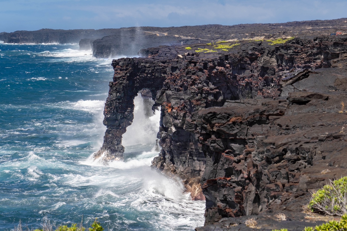
A sea arch that stood off the southern coast of Hawaii's Big Island for roughly 550 years has collapsed into the Pacific Ocean, the National Park Service confirmed this week, closing out the life of one of the most photographed natural landmarks in Hawaii Volcanoes National Park.
The 90-foot Hōlei Sea Arch was still standing on Wednesday, September 23, according to the park service. By Sunday night, September 27, it was gone. Rangers do not know the precise hour it fell, in part because the collapse likely occurred while the park was closed to the public during Tropical Storm Nolo, which strengthened into a hurricane as it passed near the islands. No one was reported injured, and officials say the arch's remoteness, on a stretch of sea cliff accessible only by a roped-off overlook at the end of Chain of Craters Road, almost certainly kept it that way.
What the park service confirmed
In a statement issued October 1, the park service described the collapse as "the latest transformation of the park's remote and rugged coastline" and said the exact timing remains unknown. The arch had been closed to foot traffic for years, with visitors restricted to a viewing area set back from the cliff edge, but rangers said photographs circulating on social media showed people climbing into the closed zone near where the arch once stood. The park service called the cliffs "unstable" and warned that sections "can collapse without warning," urging visitors to stay back from edges that drop vertically into churning surf.
The numbers behind the formation are part of what made it a draw for the roughly 1.4 million people who visited the national park in 2024, according to the park service's own visitation figures, spending that helps support more than 1,500 local jobs in nearby communities. The arch itself stood 90 feet above the waterline, was carved by what the U.S. Geological Survey has described as differential erosion acting on an ancient lava flow, and had endured since around the 15th century. Geologists had been documenting its deterioration in detail since at least 2018.
Years of warning signs
The collapse was not a surprise to anyone who has followed the arch's recent history. Earthquakes tied to the 2018 Kīlauea eruption and the dramatic collapse of the volcano's summit caldera that year damaged the cliffs flanking the arch. By January 2020, new cracks had opened in the coastal rock, prompting the park to close the original overlook entirely; a replacement viewing area farther from the edge opened that March. Later in 2020, heavy surf generated by Tropical Storm Darby broke a sizable chunk of rock from the arch's lower leg, a loss park photographers documented in before-and-after images that circulated widely at the time.
Each of those episodes drew the same warning from rangers: that the arch, a temporary feature by geological standards, could give way at any time without notice. The USGS put it bluntly in a 2014 description of the formation that has aged into something close to an epitaph.
"It will not be here forever. Every day the ocean crashes against the pillar of the arch, eroding it a little more. One day, it will be gone."
That day arrived sometime during a stretch of unusually aggressive weather. The park had already weathered Hurricane Lala in August and Hurricane Lowell in early September, both of which flooded roads, downed trees and knocked out power on the Big Island, before Tropical Storm Nolo formed in late September and rapidly intensified into a hurricane. The park service closed most of its grounds ahead of Nolo on September 24, keeping only a handful of lodging facilities open for registered guests sheltering in place, before reopening most areas three days later. The Hōlei Sea Arch overlook was not among the areas rangers reopened without caveat; the cliffs nearby remain subject to closures tied to ongoing hazard assessments.
Who is affected
The most direct effect falls on the park service itself, which now has to manage visitor expectations and the physical access points around a cliff edge that has lost a defining feature and remains geologically unsettled. Tour operators on the Big Island who built stops around the arch, along with photographers and travel writers who have long used it as shorthand for Hawaii's volcanic coastline, lose a reliable subject. The broader loss is less tangible: Hawaii Volcanoes National Park markets itself in part on landscapes that are visibly, sometimes dramatically, in motion, and the arch's disappearance is a blunt reminder that the coastline guests come to see this year will not be the coastline their children see.
Scientists who study Hawaii's coastal erosion and the long-term effects of the 2018 Kīlauea eruption on the island's cliffs also lose a monitored case study, though the broader pattern of instability along that shoreline continues regardless.
Reaction and what comes next
Coverage of the collapse, including reporting from the Guardian and local coverage from Big Island Video News, has framed the loss against a backdrop of an unusually active storm season across the Hawaiian islands, with forecasters noting that a strong El Niño pattern has been associated with more frequent tropical storm activity in the central Pacific this year. Three systems, Lala, Lowell and Nolo, struck the islands within about ten weeks of each other, compounding the kind of wave action that has been chipping away at the arch's base for years.
The park service has not announced any plan to artificially preserve what remains of the formation, consistent with its long-standing position that the arch was always a temporary feature destined to erode into the sea. Rangers are continuing to assess the stability of the surrounding cliffs and have reiterated that the viewing area near the end of Chain of Craters Road remains the only safe vantage point, even as it now looks out on open water where a 90-foot stone arch once stood. Enforcement of the closed-area boundary is expected to continue, officials said, given the images of visitors venturing past barriers in the days immediately after the collapse.
For now, the park is treating the collapse as it has treated previous losses along that coastline: as evidence of an active, unfinished landscape rather than as damage requiring repair. Visitors who make the drive to the end of Chain of Craters Road in the coming weeks will see a visibly different shoreline, and park staff say they expect the empty stretch of water where the arch stood to become, in its own right, part of what people come to see.
National Park Service — Hōlei Sea Arch Collapses in Hawaiʻi Volcanoes National Park
U.S. Geological Survey — Holei Arch (geologic description)
The Guardian — Hawaii's centuries-old sea arch collapses into Pacific after series of rough storms
Big Island Video News — Hōlei Sea Arch Collapses Into The Ocean

New Jersey Fines Microsoft-Linked AI Data Center $1.07 Million Over Illegal Generators

Medevac Helicopter Crash Off Catalina Island Kills Pilot, Flight Nurse and Patient

Wildfire Returns to Same Brunswick County Woods That Burned for Weeks This Summer
